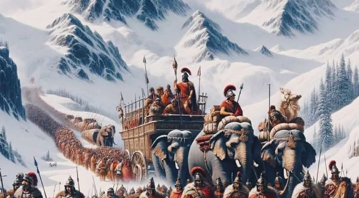
Having battled their deadly rivals the Romans in Spain, in 218BC the Carthaginian army made a move that no one expected. Their commander Hannibal marched his troops, including cavalry and African war elephants, across a high pass in the Alps to strike at Rome itself from the north of the Italian peninsula. It was one of the greatest military feats in history.

The Romans had presumed that the Alps created a secure natural barrier against invasion of their homeland. They hadn’t reckoned with Hannibal’s boldness. In December he smashed apart the Roman forces in the north, assisted by his awesome elephants, the tanks of classical warfare. Many of the animals died of cold or disease the following winter, but Hannibal fought his way down through Italy. For 15 years he ravaged the land, killing or wounding over a million citizens but without taking Rome. But when he faced the Roman general Scipio Africanus at Zama in north Africa in 202BC, his strategic genius met its match. So ended the second Punic war, with Rome the victor.
Hannibal’s alpine crossing has been celebrated in myth, art and film. JMW Turner made high drama of it in 1812, a louring snowstorm sending the Carthaginians into wild disarray. The 1959 sword-and-sandals epic movie, with Victor Mature in the eponymous title role, made Hannibal’s “crazed elephant army” look more like the polite zoo creatures they obviously were.
The battles didn’t end with Scipio’s victory, though. Much ink, if not blood, has been spilled in furious arguments between historians over the precise route that Hannibal took across the Alps. The answer makes not a blind bit of difference to the historical outcome, but there’s clearly something about that image of elephants on snowy peaks that makes experts care deeply about where exactly they went.

An international team of scientists now thinks the puzzle is largely solved. Its leader, geomorphologist Bill Mahaney of York University in Toronto, began pondering the question almost two decades ago by looking at geographical and environmental references in the classical texts. He and his colleagues have just revealed surprising new evidence supporting their claim to have uncovered Hannibal’s path.
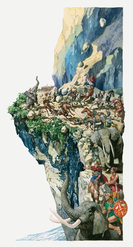
An illustration of Hannibal crossing the Alps with elephants and horses. Photograph: Getty Images/Dorling Kindersley
The three Punic wars were a struggle for dominance of the Mediterranean region by the two great trading and military powers of the third and second centuries BC: Carthage and Rome. Carthage, a former Phoenician city-state in present-day Tunis, had an empire extending over most of the north African coast as well as the southern tip of Iberia. Rome was then still a republic, and the two states were locked in a power struggle apt to flare into open war, until the Romans annihilated Carthage in 146BC.
Hannibal, son of general Hamilcar who led troops in the first Punic war, gave Carthage its most glorious hour. He is ranked alongside Alexander the Great, Julius Caesar and his nemesis Scipio as one of the greatest military strategists of the ancient world, and his alpine crossing plays a big part in that reputation. Most of what we know about it comes from the accounts given by the Roman writers Polybius (c200-118BC) and Livy (59BC-AD17). They make it sound truly harrowing.
As the Carthaginian army ascended from the Rhône valley in Gaul, they were harassed and attacked by mountain tribes who, knowing the territory, set ambushes, dropped boulders and generally wrought havoc. During the descent the Carthaginians were mostly unmolested, but now the mountains themselves threatened mortal danger. The Alps are steeper on the Italian side, and the path is narrow, hemmed in by precipices.
“Because of the snow and of the dangers of his route [Hannibal] lost nearly as many men as he had done on the ascent,” wrote Polybius. “Since neither the men nor the animals could be sure of their footing on account of the snow, any who stepped wide of the path or stumbled, overbalanced and fell down the precipices.”
At length they reached a spot where the path suddenly seemed impassable, as Livy describes it: “A narrow cliff falling away so sheer that even a light-armed soldier could hardly have got down it by feeling his way and clinging to such bushes and stumps as presented themselves.”
“The track was too narrow for the elephants or even the pack animals to pass,” writes Polybius. “At this point the soldiers once more lost their nerve and came close to despair.”
Hannibal tried a detour on the terrifying slopes to the side of the path, but the snow and mud were too slippery. So instead he set his troops to construct a road from the rubble, and after backbreaking labour he got the men, horses and mules down the slope and below the snowline. The elephants were another matter – it took three days to make a road wide enough. Finally, says Polybius, Hannibal “succeeded in getting his elephants across, but the animals were in a miserable condition from hunger”.
Where exactly Hannibal crossed the Alps was a point of contention even in the days of Polybius and Livy. Nineteenth-century historians argued about it, and even Napoleon weighed in. The controversy was still raging a hundred years later. Some authorities proposed a northerly path, past present-day Grenoble and through two passes over 2,000 metres high. Others argued for a southerly course across the Col de la Traversette – the highest road, reaching 3,000m above sea level. Or might the route have been some combination of the two, starting in the north, then weaving south and north again?
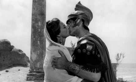
Victor Mature and Rita Gam in the 1959 film Hannibal. Photograph: Alamy
The southern route was advocated in the 1950s-60s by Sir Gavin de Beer, director of the British Museum (natural history), who published no fewer than five books on the subject. He combed the classical texts and tried to tie them in to geographical evidence – for example, identifying Hannibal’s river crossings from the timings of floods. “All of us more or less follow de Beer’s footprint,” says Mahaney.
For Mahaney, it began as a hobby and become a labour of love. “I’ve read classical history since my ordeal getting through four years of Latin in high school,” he says. “I can still see my old Latin teacher pointing his long stick at me.”
He went looking for clues in the landscapes. Both Polybius and Livy mention that the impasse faced by Hannibal was created by fallen rocks. Polybius, who got his information firsthand by interviewing some of the survivors from Hannibal’s army, describes the rockfall in detail, saying that it consisted of two landslides: a recent one on top of older debris. In 2004 Mahaney found from field trips and aerial and satellite photography that, of the various passes along the proposed routes, only the Col de Traversette had enough large rockfalls above the snowline to account for such an obstruction.
There’s an old, steep track of rubble leading out of this pass – which might conceivably be based on the very one made by Hannibal’s engineers. What’s more, in 2010 Mahaney and co-workers found a two-layer rockfall in the pass that seemed a good match for that which Polybius mentioned. “No such deposit exists on the lee side of any of the other cols,” he says.
He suspects Hannibal did not intend to come this way, but was forced to avoid the lower cols to the north because of the hordes of Gauls massing there. “They were every bit Hannibal’s equal, and no doubt hungry to loot his baggage train,” Mahaney says.
The rockfall evidence was pretty suggestive. But could Mahaney and his team of geologists and biologists find anything more definitive? Since 2011 they’ve been looking in a peaty bog 2,580m up in the mountains, just below of the Col de la Traversette. It’s one of the few places where Hannibal’s army could have rested after crossing the col, being the only place in the vicinity with rich soil to support the vegetation needed for grazing horses and mules.
The researchers rolled up their sleeves and dug into the mire. What they found was mud. And more mud. Not very informative, you might think. But mud can encode secrets. Taking an army of tens of thousands, with horses and elephants, over the Alps would have left one heck of a mess. More than two millennia later, Mahaney might have found it.
The peaty material is mostly matted with decomposed plant fibres. But at a depth of about 40cm this carbon-based material becomes much more disturbed and compacted, being mixed up with finer-grained soil. This structure suggests that the bog became churned up when the layer was formed. That’s not seen in any other soils from alpine bogs, and isn’t easily explained by any natural phenomenon such as grazing sheep or the action of frost. But it’s just what you’d expect to see if an army with horses and elephants passed by – rather like the aftermath of a bad year at the Glastonbury festival. This soil can be radiocarbon-dated – and the age comes out almost spookily close to the date of 218BC attested by historical records as the time of Hannibal’s crossing.
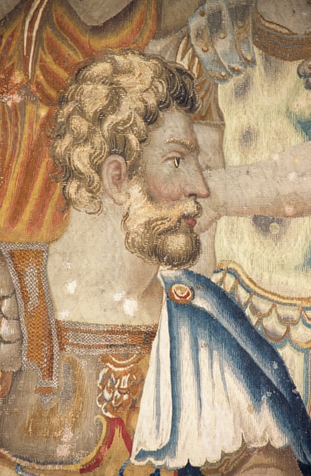
Publius Cornelius Scipio Africanus, the Roman general who defeated Hannibal at the battle of Zama in 202 BC. Photograph: Alamy
The researchers then took samples of this disturbed mud back to the lab, where they used chemical techniques to identify some of its organic molecules. These included substances found in horse dung and the faeces of ruminants. There’s some of this stuff throughout the mire mud, but significantly more in the churned-up layer.
What’s more, this section also contained high levels of DNA found in a type of bacteria called clostridia, which are very common in the gut of horses (and humans). In other words, the layer of disturbed mud is full of crap (perhaps not so different from Glastonbury either). Aside from a passing army, it’s not easy to see where it might have come from – not many mammals live up here, except for a few sheep and some hardy marmots.
That’s not all. Microbiologists collaborating with the team think they might have found a distinctive horse tapeworm egg in the samples. “There is even the possibility of finding an elephant tapeworm egg,” says Mahaney’s long-term collaborator, microbiologist Chris Allen of Queen’s University Belfast. “This would really be the pot of gold at the end of the rainbow.” It’s just a shame, he adds, that “the pot of gold is actually a layer of horse manure”. Evidence of elephants at the site would surely be a smoking gun, since you don’t find many of them wandering wild in the Alps.
Meanwhile, Mahaney hopes, if he can find the funding, to mount a radar survey of the entire mire and other mires nearby to search for items dropped by the passing army. “My sniffer tells me some will turn up,” he says – “coins, belt buckles, sabres, you name it.”
Unless they do, other experts may reserve judgment. Patrick Hunt, an archaeologist who leads the Stanford Alpine Archaeology Project, which has been investigating Hannibal’s route since 1994, says that the answer to the puzzle “remains hauntingly elusive”. It’s all too easy, he says, for fellow experts to adduce evidence for their favoured route – his team argues for a more northerly path – but until the same methods and rigour are brought to bear on all the alternatives, none can be ruled out. All the same, he adds, Mahaney is one of the best geo-archaeologists working on the question. “He continues to be a trailblazer in the field,” says Hunt, “and I’d love to collaborate with him, because he’s asking excellent questions.”
If Mahaney can secure firm evidence – such as chemical or microbial fingerprints of elephant faeces – it would be the culmination of a personal quest. “The Hannibal enigma appealed to me for the sheer effort of getting the army across the mountains,” he says. “I have been in the field for long times with 100 people, and I can tell you it can be pandemonium. How Hannibal managed to get thousands of men, horses and mules, and 37 elephants over the Alps is one magnificent feat.”
