By Ismayil Güracar –
Nearly a decade ago I took a solo road and hiking trip along the Likya Yolu or Lycian Way where I encountered the main subject of this article. The Lycian Way is a nearly 500 km (300 mile) marked trail between Fethiye and Antalya along the southwestern coast of Turkey and is popular with long distance walkers (Figures 1a and 1b) [1]. Turkey contains a large number of interesting archaeological sites and among the many along the Lycian Way is the city of Patara, the ruins of which are today found near the village of Gelemiş. Patara was the leading city and main harbor of the ancient Lycian League, an early example of a democratically organized collection of city states with the innovation of proportional representation that later provided inspiration to the founders of the United States. The Lycians eventually succumbed to the Romans and Patara was annexed by the Roman Empire in 43 CE, growing to be an important link in Mediterranean maritime trade, particularly Egyptian grain [2] [3].
When the Romans took over one of the important orders of business was to secure a water supply to provide for the needs of a proper Roman city, with multiple buildings for baths and a monumental arch which also doubled as an aqueduct (Figures 2a and 2b).
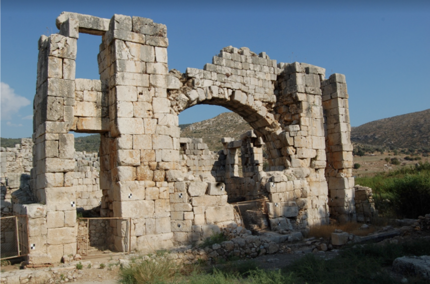
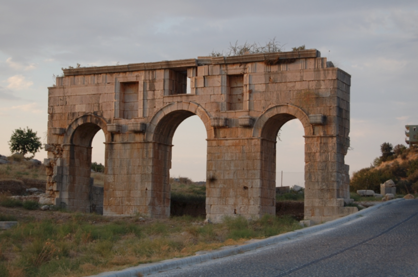
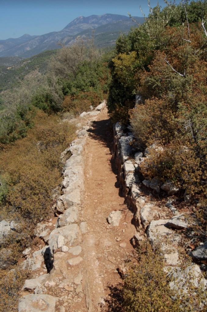
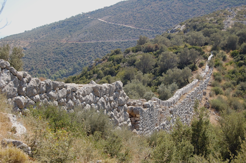
The 22.5 km (13.5 mile) system brought water to the city of Patara from mountain springs and was originally constructed during the reign of Claudius (41 to 54 CE). Portions of the Lycian Way hiking trail actually follow the open masonry water channel (Figure 3) which was built directly on top of limestone karst bedrock and, following the contours of the mountains, dropping nearly 600 meters (almost 2000 feet) over its entire length’an average grade of about 2.7%.
A section of the aqueduct spans an 18 meter (59 feet) deep mountain saddle (Figure 4). The Turkish word ‘delikkemer’ which is the current local name for this structure literally translates to ‘arch with a hole’.
In order to traverse the span, a 3 meter (10 feet) thick, 10 meter (33 feet) high Cyclopean wall was constructed as a bed for the inverted siphon water channel (Figure 5).
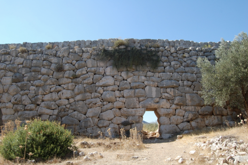
The Cyclopean wall contains interlocking randomly placed blocks that bring to mind Peruvian masonry. This arrangement greatly increases resistance to earthquakes and is easier to construct than the typical Roman arched aqueducts found elsewhere, at the expense of requiring more stone material.
The original Claudian era inverted siphon was destroyed in a large earthquake in 68 CE and, based on fragmentary material found at the site, consisted of multiple parallel channels of ceramic pipe. Analysis of carbonate deposits on the ceramic pipe fragments indicate that the original aqueduct was active for 17 years, starting in 51/52 CE [3]. Inscriptions on ashlar blocks incorporated into the wall (Figure 6) document the restoration of the wall and siphon under Vespasian (69 to 79 CE) and further explain that the restoration was accomplished without the requirement for additional taxes or payments by the local citizenry. Credit is given to the local Roman administrators (legates) acting on behalf of the emperor.
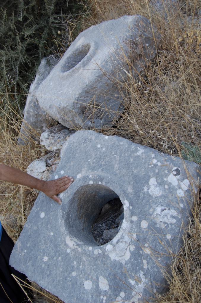
Each ashlar limestone block (Figure 8) weighs nearly 900 kg (2000 lbs.) with a dimension of 90 cm x 90 cm x 50 cm (35 in x 35 in x 20 in) and pierced with a central hole with diameter of 30 cm (11.8 in). The blocks interlock and, with the help of hydraulic cement, are designed to form a watertight seal able to withstand significant water pressure.
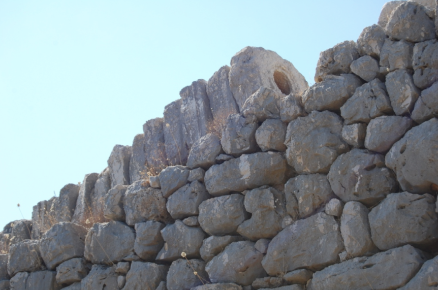
The interlocking blocks were held tightly together with metal clamps which are now lost (Figure 9). The holes for the clamps between adjacent pairs of blocks are still visible. It has been noted that the “curvilinear alignment of the conduits” along the length of the wall (Figure 10) was likely related to the regulation of pressure [3] but this waviness would have also made it easier to remove and replace blocks for cleaning and repair as there would be some ability to shift nearby blocks to open up a small group of the tightly aligned blocks with enough clearance to get access without having to disassemble the entire length of the siphon.
Fig. 10 Water Siphon Blocks Resting On Top of the Wall
Some of the pierced blocks have additional holes to facilitate cleaning of the water conduit without needing to separate clamped groups of blocks.
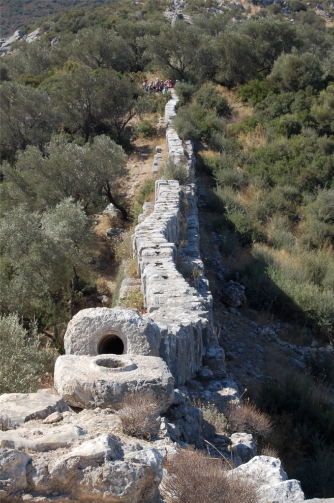
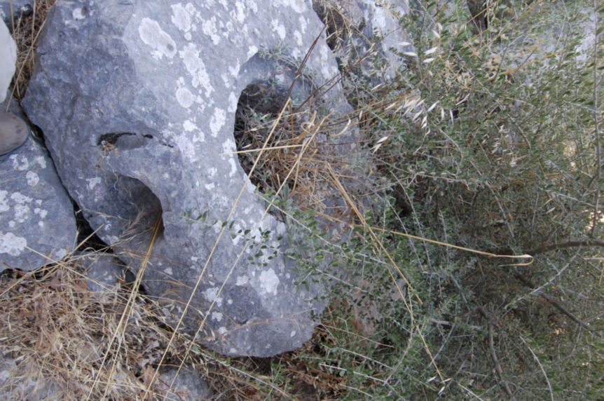
Fig. 11 Additional Piercings for Cleanout Access
The Romans were practical and economical in their use of material and labor and the engineering decisions made in construction can be explained in light of this.
If the engineers designing this inverted siphon had instead elected to omit the 10 meter high wall, the water pipes would have had to be laid over the full 18 meter descent to the valley floor and would have required the inverted siphon pipes to handle more than double the pressure (an 18 meter water head versus an 8 meter head) over a longer distance in order to follow the contours of the valley. This would have increased the risk of leaks, vulnerability to earthquakes, and made maintenance more difficult.
Alternatively, a hypothetical higher wall would have avoided the need for the very heavy pierced blocks and the maintenance demands of the high pressure water channel for the inverted siphon as the water path could instead have been a simple open or covered masonry channel. Nearly doubling the height of a wall (from 10 meters to 18 meters) requires nearly four times more stone material as the base of the wall must increase proportionally in width to accommodate the additional height and weight to maintain stability–a huge increase in material and construction labor.
The choice to traverse the valley with a siphon with a pipeline under moderate pressure on top of a wall of moderate height demonstrates a carefully considered engineering tradeoff to optimize cost and effort while delivering one of the core essentials of civilization’ample amounts of fresh water.
Today the ancient Patara harbor is silted up, buried beneath a long stretch of beach that is now shared between the annual nesting sites of the endangered loggerhead sea turtle (Caretta caretta) and the locus for vacationing beachgoers along the Turkish Riviera. The fresh water supply for the nearby village of Gelemiş is today provided in part from the same ancient spring and traverses a similar path as in ancient Pataran times, albeit with modern metal piping.
